Yucatán Road Trip: Balamkú

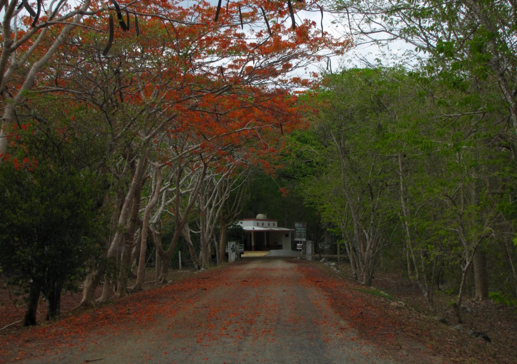
Traversing the distance between the city of Campeche and the hotels surrounding Calakmul takes about four hours, with little in the way of either gas stations or open archaeological sites in between. Over three hours and 150 miles after leaving our hotel we reached our first stop: the partially excavated site of Balamkú. Situated about 30 miles north of Calakmul in the southernmost part of the Maya lowlands, Balamkú was (re)discovered in 1990 and excavations began in 1994. Today, only the central and southern groups have been exposed. A stroll around the grounds reveals a series of attractive but relatively simple ruins picturesquely overgrown with slim, hardy trees and neatly kept by the groundskeeper.

To find Balamkú’s most impressive feature, however, visitors must search a little deeper. We wandered cluelessly for a while before the groundskeeper came up and indicated we should follow him. He led us up a narrow metal staircase alongside one of the site’s larger buildings (Structure 1 of the Central Group), unlocked the door, and ushered us inside. We found ourselves within a long, narrow chamber lit purely by the natural light filtering through a series of small, square holes in the ceiling. To out left stood one of the longest and oldest known painted stucco friezes of the Mayan world.

Stretching 55 ft across, the frieze once included four columns topped by rulers, separated by jaguars or jaguar-like creatures. According to the signage (or at least my questionable translation of the signage), the kingly uppermost figures—of which only one and a half of the original four remain—do not possess any uniquely identifying features and thus likely represented the concept of rulership rather than specific individuals. Each emerges from the jaws of an amphibian—again, according to the INAH sign—representing the fertile aspect of the world. The king’s birth from a creature that can move between water and earth suggests his ability to likewise move between worlds. Each “amphibian” sits upon a mask of the Earth Monster similarly representing the richness of the world while also evoking the four directions.

Jaguars—symbols of sacrifice, war, and death, as well as the risen and subterranean sun—and Jaguar hybrids fill the panels between the masks and provided the inspiration for the site’s current name (balam=jaguar, kú=temple, Balamkú=Temple of the the Jaguar). Taken as a whole, the frieze celebrates and glorifies Balamkú’s rulers and their intimate connection with a healthy and bountiful world.

The INAH website offers a slightly different iconographic summary, suggesting that composition equates the dynastic cycle with the solar cycle. In this view, the image of the ruler emerging from the jaws of the Earth Monster symbolizes his ascension to the throne just as the sun comes out of the earth at dawn, and the ruler’s death is shown at sunset, when he falls back into the Earth’s mouth.

All photos by Renée DeVoe Mertz, May 27, 2015.

Yucatán Road Trip: Museo Arqueológico de Campeche, Fuerte de San Miguel

The Archaeological Museum of Campeche (Museo Arqueológico de Campeche) is located in Fuerte de San Miguel, a short drive south of the city center. Begun in 1771, the colonial, sea-facing fortress is a major landmark in its own right, included in UNESCO’s designated World Heritage Site of the Historic Fortified Town of Campeche. Its barrel-shaped chambers and brightly painted courtyard create a dramatic frame for the museum’s excellent collection of Maya artifacts, including Jaina figurines, stelae and jade from Calakmul, as well as skulls exhibiting artificial cranial deformation. The presence of a friendly cat wandering the grounds also didn’t hurt our impression of the site.

Taken as a whole, the Museo Arqueológico was not only the largest museum we visited in Campeche, but also our favorite, rivaling even the monumental and more modern Gran Museo del Mundo Maya in Mérida for the most enjoyable museum of our trip.

Highly subjective personal rating: 8/10
[If you go to only one museum in Campeche, go here.]

All photos by Renée DeVoe Mertz, 26 May 2015.

Yucatán Road Trip: Baluarte de Santiago and Baluarte de la Soledad, Campeche

Campeche’s city center is circumscribed by the remains of a hexagonal wall built by the Spanish between 1686-1704 to defend the colonial seaport from pirate attack (UNESCO). Remarkably, much of the early fortification, including its eight bastions (baluartes), still exists. These bulwarks are now historical attractions in their own right, protected as part of the city’s UNESCO World Heritage Site, and a few have been turned into small museums to showcase other highlights of the region. Baluarte de Santiago, for instance, is now home to the Xmuch’haltun botanical garden of subtropical plants, while Baluarte de la Soledad houses the Museum of Maya Architecture with a small but impactful collection of Maya ceramics and useful information on nearby sites, including Calakmul, Hochob, and Hormiguero.

Highly subjective personal rating: 7/10

Baluarte de Santiago

img_5056-copy

img_5057-copy

img_5070-copy

img_20150526_0912262-copy


Baluarte de la Soledad

All photos by Renée DeVoe Mertz, May 26, 2015.

Yucatán Road Trip: Hochob

img_4937
Hochob’s Structure 1. A metate (grinding stone) is visible on the right side of the image, near the base of the building.

From Edzná we began our trek to Hochob, the first Chenes-style site of our trip.

In contrast to the well-trod, well-maintained routes that had led us to every archaeological area up to this point, the way to Hochob was largely unmarked and required the use of narrow, rough, and unnamed roads. It would have been nearly impossible to find without a GPS, and was challenging even with one. So challenging, in fact, that we ended up using two different apps simultaneously (one on each phone), comparing and contrasting the maps they showed us as we inched our way towards our destination.

pano_20150525_115653
Ceremonial center of Hochob. According to the INAH website, the site was inhabited from 300 CE “until long after the Spanish conquest,” reaching its peak around 850-1000 CE. However, the extant buildings mostly precede the city’s height and date to 600-900 CE.

As should be expected given its small size, remote location, and frequent absence from guidebooks, Hochob is not the bustling tourist beacon of places like Chichén Iztá or even Dzibilchaltún. The handful of other visitors we encountered during our stay consisted entirely of a Mennonite family and a father with his young son, all of whom explored the site with the casualness of locals on family outings. They were pleasant co-adventurers, and their presence amongst the ruins, vultures, and stark, twisting vegetation lent an almost cozy feel to the otherwise spooky beauty of the site itself.

img_4940-2

Unlike Edzná, whose residents had to create a massive platform to lift their ceremonial center above the surrounding valley, Hochob was built at the peak of a natural hill. Its population then expanded downward, creating terraced housing along the hillside (INAH). To reach the site now, visitors ascend a modern stairway composed of large, rounded steps that snake up the steep slope like a vertical conveyor belt.

img_5029-1

As we neared the top, we were greeted by an enormous, gaping face rising out of the cleared space of the courtyard. Although not the only building in the ceremonial center, this structure, known as the Palace, is by far the best preserved and most dramatic of the entire site.

img_4930-1

According to the plaque for the Palace (also referred to, less grandly, as Structure 1), the elaborate façade of the three-roomed building is a depiction of Itzamná, the Maya creator deity. Itzamná appears crouching and open-mouthed, with hook-like stones around the entrance forming the teeth of the god’s upper jaw and back molars. Narrow slabs protruding from the platform beneath the entrance represent the front teeth of its lower jaw.

img_4946

Remnants of both the stucco and red and black paint that once covered all of the center’s buildings still cling to the Palace’s exterior. Patches of red paint are especially visible in the crevices of Itzamná’s spiral eyes.

img_4951-1

Use of an open-mouthed visage surrounding a central doorway and bordered by stacked, long-nosed masks is typical of Chenes architecture, a style that flourished from 600-800 CE in the region around Campeche and reached as far north as Uxmal, where another, similar face forms the focal point of the Pyramid of the Magician. At least two of the major buildings around Hochob’s small courtyard once possessed these masked façades, although the top half of the second structure is now missing.

Version 2
Structure 1 (left) and a second, less preserved masked building (right, background).

After exploring the Palace and surrounding buildings, we followed a path extending from the side of the courtyard opposite the stairs. This trail was dotted with the chultuns that once stored water for Hochob’s inhabitants and made their life on the hill possible.

img_5002-2

The simple, almost perfectly round holes had their own kind of stark (if slightly precarious) elegance, and we appreciated the opportunity to see them up close even as we tried to avoid accidentally stumbling into them.

img_5014

It was not yet mid-afternoon by the time we completed our nature walk/chultun stroll and made our way back down the generous staircase to the parking lot. Given the early hour, we briefly considered trying to add Santa Rosa Xtampak, the former capital of the Chenes region, to the day’s itinerary. Unfortunately, although less than 60 miles separate the two sites, there is no route between them that would take less than two hours. Going would have put us in high risk of trying to find our way back to Campeche in the dark, a prospect neither Josh nor I considered with relish. And so, happy with what we had seen but now also disappointed with what we were not able to do, we began the long, slow return journey to our hotel and a relaxed evening back in Campeche.

Highly subjective personal rating: 8/10 [worth the trek]

img_5021-copy

Yucatán Road Trip: Edzná

IMG_4826 (1)
Cross-eyed mask of the rising sun, Temple of the Masks, Edzná.

Edzná’s ruins lay about 50 km to the southeast of Campeche, with the way clearly marked by official traffic signs along (mostly) good roads. And yet, even with this relative ease of access from the region’s capital, we shared the impressive city with only a few other tourists.

img_4915-copy
View from the steps of Edzná’s Acropolis.

Most of the existing architecture here dates to 750-950 CE and is Puuc in style, making Edzná the southernmost city of the Puuc culture. However, the area was populated long before the Puuc’s arrival. According to Coe, the first inhabitants settled the valley around 400 BCE, when the Maya of the Petén region migrated north (343). Unlike the arid climate found elsewhere on the peninsula, the valley containing Edzná provided good soil and relatively easy access to water, although lack of drainage and the persistence of a long dry season initially limited its productivity. To counter this cycle of drowned and dried crops, the inhabitants eventually “built the most extensive canal and irrigation network in the Maya region” to drain excess water and save it for the dry months (343). This in turn allowed the small agricultural and trading town to grow into an important and heavily populated center.

img_4877-copy

There are several groups of buildings within the extensive site, but our visit focused primarily on three highlights. The first of these was the collection of stelae located in a modern, thatched structure between the parking and main archaeological areas. Although they vary in size and condition, a number of the stelae here still display a high degree of detail and are accompanied by good explanatory text in Spanish.

IMG_4797 (1)
Stela 2. According to its sign, this stela depicts the victorious ruler of Edzná standing above the gateway to the underworld (right) while looming over a high-ranking captive (left). The presence of a ball between the figures indicates that this scene represents the end of a ritual ballgame, likely in the moments just before the ruler sacrificed the vanquished captive. The hieroglyphs at the top of the stela provide a date of 9.15.0.0.0 (August 22, 731 CE).

Two, Stelae 8 and 9, are particularly unusual in the way they present the human form. Whereas figures on stelae typically appear in profile and face inward, their actions illustrating an important historical moment (see Stela 2, above), those on Stelae 8 and 9 simply stand back-to-back. Their bodies fill the front of the stone, pushing their profiles to the corners so that their faces wrap around to the sides’ edges (see Stela 9, below). Despite the lack of obvious action, the inclusion of a date in the band of glyphs near the top of the stone suggests that these figures also represent a specific historical moment.

IMG_4804
Stela 9. One of two stelae at Edzná with figures standing back-to-back, their faces wrapped around opposite corners of the stone slab. Both hunchbacks wear jewelry, feathered capes, and belts decorated with the “mat” symbol of power. A date recorded in the upper hieroglyphic band corresponds to June 28, 810 CE.

From the stelae pavilion, we entered the archaeological area and made a beeline south through the Main Plaza, past the Great Acropolis, to the small but exciting Temple of the Masks.

IMG_4840 (1)

Another thatched roof covers and protects the pair of well-preserved painted stucco faces that grace the temple’s base, while a thin rope fence discourages visitors from getting within touching or climbing distance of the building. The wide-eyed masks, one on each side of the central staircase, are probably personifications of the rising and setting aspects of the sun, represented by a youth to the east (left) and an elderly male to the west (right). Both aspects possess large earspools and what appear to be jutting, upper teeth. Crossed eyes, a sign of beauty, are especially noticeable on the young, eastern face.

IMG_4848 (1)
Mask of the rising sun.
IMG_4829 (1)
Mask of the setting sun.

Doubling-back, we returned to the Main Plaza and climbed the steps up the massive stone-and-earth platform that supports Edzná’s Great Acropolis.

PANO_20150525_101501_reframed
360-panorama of Edzná’s Gran Acrópolis showing the central staircase and medium temple pyramids (far left and right), northern temple (left), Building of the Five Stories (center), and Temple of the Moon (right).

Upon reaching the summit, we were immediately struck by both the enormity of this entirely man-made square and the almost pristine geometry of its structures. However, our attention soon turned to a single focal point. Across the courtyard, directly opposite the staircase, loomed the Building of the Five Stories, a great pyramidal monument standing twice as high as its most substantial neighbors.

img_4908-1

Although similar in size and shape to the grand pyramids of other sites, in function the Building of the Five Stories has more in common with the palaces of the central Puuc region. Whereas Maya pyramids are largely solid structures built to support temples on their uppermost stories and/or contain sealed, hidden burial chambers, the façade of the Building of the Five Stories is punctured at every level with open doorways leading to vaulted rooms. On May 1 and August 13, the setting sun fills these chambers with light (Coe 347). The structure thus probably served as both a residential building for the elite and as a ritual focal point for the city as a whole.

img_4886-copy

Visitors can no longer climb up the Building of the Five Stories, but they can still get quite close to its lower steps. Upon inspection, these stairs revealed rows of stones decorated with large glyphs. Known as the Hieroglyphic Staircase, the wide, deep steps leading from the ground to the first story possess some of clearest writing and low-relief sculpture we encountered in situ over the course of our trip and were, for us, Edzná’s final highlight.

Highly subjective personal rating: 8/10

img_4885-copy

Yucatán Road Trip: Loltún

loltun_opening_by_rm

Loltún (aka, Lol-tun or Grutas de Loltún) is an expansive network of caverns located in the northern Puuc region of the Yucatán Peninsula about 20 km (at least 30 minutes by car) northeast of Labná. The inhabitants of the Yucatán have used the caves here for thousands of years for both practical and sacred purposes: as a source of water, clay, and shelter; as a burial place; as a pilgrimage destination; and, more recently, as a defense during the Caste War (1847-1901).

Despite my initial enthusiasm for what promised to be a naturally and culturally fascinating site, as the day of our visit approached I found myself torn about embarking on another cave tour after our experience at Balankanché. On the one hand, I had been looking forward to seeing Loltún’s rock paintings and in-situ artifacts for months. On the other, I really did not enjoy the sensation of having my lungs squeezed or the subsequent panic attack that came with it. Therefore, the night before we were scheduled to head to Loltún, I decided to read some of the more recent descriptions on TripAdvisor to get a better sense of what we were in for.

That decision turned out to be a mixed blessing. While I didn’t find any signs we would experience the same level of discomfort we had at Balankanché, I did come across a few reviews by angry visitors stating that after paying the entrance fee and going on the tour, their guide had insisted upon tips of 500 pesos (between $25-$30) per person. Not only was this much higher than the going rate for guides at any other place we had encountered, but when taking the day’s expenses of hotel and gas into account, it was more cash than we had. In addition, ATMs—like gas stations—are fairly rare commodities in this area; the only one we knew of for certain was at Uxmal, but there was no way of getting to it without spending precious time and gas driving out of our way and then paying for parking again.

After some debate, we decided to take our chances and stick to our original plan of going to Loltún, put aside as much cash as we could, and just look for ATMs along the way. (We didn’t find any.) After all, we reasoned, if guides wanted to require high, unstated costs that most visitors couldn’t reasonably be expected to be prepared for, surely there must at least be an ATM at the site. (There wasn’t.)

By the time we finally reached Loltún, we were low on both cash and gas, leaving me high on anxiety. At the welcome center, we looked in vain for any indication of what the cost of the guide should be, but saw only the (also rather high) entrance fee. We swallowed hard and paid for our tickets, then waited.

The crowd grew considerably over the next 20 minutes, until eventually the guides approached and shuffled us into two, large groups of around 12 people each. Although tours were supposed to be available in English or Spanish, and although there were still several guides who did not accompany either group, both tours were in Spanish. I was disappointed until I realized that being handled like extra luggage rather than actual members of a tour relinquished us from the pressure of giving a particularly high tip. I was finally able to relax. A little.

Without the insight of a guide, we relied on the dual-language signs posted at some of the important stopping points along the path, as well as Andrew Coe’s guidebook, for information on the history of the cave. Mostly, though, we just focused on what we saw and tried not to fall as we slipped over slick, sometimes steep, and often dark paths that connected the caverns’ dramatically lit highlights, including the roughly carved “Head of Loltun;” hand paintings; and the giant “Room of Inscriptions,” which is naturally illuminated by two, large holes in its ceiling. Crucially, these openings let in air as well as light, and are thus partially responsible for the cave’s relatively cool—and breathable—climate. Even with the more pleasant temperatures, however, the caverns were still quite humid and some of the smaller spaces became less-than-comfortable when filled with people. The precariousness of the paths, too, make Loltún a destination that requires at least a moderate level of fitness and lack of fragility, not to mention a pair of good, grippy shoes.

Even though we couldn’t follow most of what was being said, the guide still enabled us to navigate the sometimes precarious terrain, in one spot acting as a physical anchor and pulling us up a particularly difficult incline. At the end of the tour, we handed him all the money we had set aside (minus a small amount held back for buying the gas we would need to get to Campeche that evening) and he accepted it with a thank you and without a second glance.

Would we go back? Probably not. Even a year later, a smog of stress still hangs over my memories of our visit. But much of what we saw was spectacular and unlike anything we encountered elsewhere. All-in-all, I’m glad we went and mostly wish I hadn’t worried so much along the way.

Highly subjective personal rating: 6.5/10 [Actual content of the caves: 8/10; experience leading up to and during the tour: 5/10]

loltun_entrance_relief_by_rm
Low relief carving of the seated “Loltun Warrior” and column of glyphs at the entrance to the caves. According to Coe, the oversized figure is probably a portrait of a ruler from Izapa, a pre-Classic city in southern Chiapas, and may be evidence of Loltún’s role as a pilgrimage site.
loltun_head_by_rm
“Head of Loltun” positioned at the end of the spacious “Cathedral” chamber. The head was actually found elsewhere in 1960 and moved to its present, theatrical location.
loltun_handprints_by_rm
Positive and negative (silhouetted) paintings of hands on the walls of the “Child’s Room.” The chamber is named for the burial of a 10-year-old boy whose body is now in Mérida.
loltun_cave_large_room_by_rm
The “Room of Inscriptions,” with person for scale.

Yucatán Road Trip: Labná

IMG_4684 resized

Driving another three km east from Xlapak took us to Labná, the last of the ancient cities along the Ruta Puuc included within Uxmal’s World Heritage site. Labná is a bit smaller than Kabah and Sayil, and is one of the oldest cities of the region. The primary buildings, including the palace, gateway, and mirador (observatory), are notable not only for their unusually well-preserved state, but for being particularly emblematic of the Puuc style in both architecture and decoration, with myriad long-snouted masks, attached columns, step-and-fret designs, and even figural reliefs gracing their exteriors.

According to the entranceway plaque, Labná’s origins likely date “from around the beginning of our era,” although the remaining structures are the result of multiple building phases from 750 to 1000 CE. Like the other cities in this arid area, Labná depended on its ability to catch and store rainwater, which it did using nearly 70 chultuns (narrow, domestic cisterns) and a natural aguada (sealed depression in the land, similar to a cenote).

labna_palace_and_sacbe_by RM
View of Labná’s palace from the southeast, with the connecting sacbe visible on the left.

The palace is the first major building visitors encounter within the archaeological area. Set on a platform and facing the sacbe that still connects it to the residential and mirador groups located directly to the south, this structure is the largest of several buildings that make up the “palace group.” Although shorter and less imposing than Sayil’s three-story version, Labná’s palace has the relative advantage of being more accessible and better preserved. And its many nooks and crannies do benefit by close inspection.

Labna palace detail with warrior and Chaac by RM
Long-snouted mask (center) and partial warrior statue (left) on Labná’s palace.
Labna palace passage by RM
Vaulted passageway joining two of the palace’s buildings.
Labna palace detail by JA
Long-snouted mask with remnants of red paint.
room interior of Labna's palace by RM
Swallow living in a room of Labná’s palace.
Labna palace detail by RM
Detail of Labná’s palace showing head emerging from one of the most elaborate long-snouted masks of the region.
Labna palace detail, alt view by RM
Alternative view of the heavily decorated corner of Labná’s palace. Note the second human face at the base of the building, beneath the attached columns.

From the palace, visitors can take a path east to the “Edificio de las Columnas,” an L-shaped residential structure built in the Puuc Junquillo style, or walk south to Labná’s most distinctive feature: its gate.

Labna's_gate_west_side_by_RM
West side of Labna’s gate decorated with mat designs and miniature huts.
Labna's_gate_east_side_by_RM
Step-and-fret motif on the east side of Labná’s gate.

As an imposing structure that simultaneously limited and permitted movement between two plazas, the gate would have both connected and demarcated the spaces of the residential group to the west of the sacbe and what was likely a ceremonial center to the east [ref. map]. Iconographically speaking, the western face is the more exciting façade, with its miniature huts flanking either side of the archway. Each hut’s niche once contained a brightly painted stucco sculpture of a seated warrior, remnants of which are still extant today. The blue-green headdress and red walls are especially visible in the niche to the right (south) of the central doorway.

Labna's_gate_west_side_detail_by_RM
Detail of the west side of Labna’s gate with El Mirador in the background. The niche within the miniature Maya hut contains red and blue-green paint where a stucco warrior used to be.
Labna's_gate_niche_detail_by_RM
A bluish, stucco headdress; red walls; and jutting support stone are all that’s left of the warrior who once sat within the right niche of Labná’s gate.

For us, the gate is also memorable as the place where, while trying to 123D Catch the exterior, Josh smacked his head, skinned his shin, and bruised his foot falling down a pile of rubble. The experience was a good reminder to stick to the better-worn paths or, at the very least, to avoid unsure footing while wearing sandals.

labna_gate_residential_group_and_el_miriador_by_RM
View from the “residential group” of the gate, el Mirador, and a particularly aggressive pile of rubble.

To the east of the gate stands el Mirador, a 20 meter, pyramidal heap of stones topped by a small temple with a giant roof comb.

Labna_el_mirador_by_RM
El Mirador, Labná.

The many support stones on the south side of the comb are evidence of elaborate stucco work that once covered the front of the building and, like the archway, was probably brightly painted. Although we know from early descriptions that most, if not all, of this decoration consisted of human figures, very little of the original ornamentation has survived [ref. image]. Fortunately, it doesn’t take a great deal of imagination to understand that this area—which is still impressive in its denuded state—would have been spectacular in its original condition.

Labna_trees_by_RM
Western path through Labná. Part of the palace is visible on the lower right.

We eventually returned to the welcome center via a more shaded (and rather beautiful) path on the western side of the site before once again hopping into our car and heading to Loltun cave, our final archaeological stop in the region and of the day.

Highly subjective personal rating: 7.5/10

Yucatán Road Trip: Xlapak

IMG_4608
Structure 1, Xlapak.

Departing from Sayil, we continued east for 5.5km until we reached another gravel drive branching off to the south, this time leading to Xlapak.

Unlike the other stops along the Puuc Route, little Xlapak is not officially inscribed by UNESCO within the Uxmal World Heritage Site. This is probably because the visitable area includes only one well-preserved building (Structure 1, aka, the “palace”), while the rest of the former city still lies in near-complete ruin. And yet, the singularity of this building, which seems to stand alone within an encroaching jungle, lends it a jewel-like quality unmatched by the larger and more elaborate structures elsewhere.

IMG_4629

From the parking area, we followed a stone-lined footpath under a canopy of slender but densely growing trees. After the open and expansive locations of Sayil, Kabah, and Uxmal, the trail through Xlapak felt unusually intimate—almost eerily so.

After about 200 meters, we arrived at the north façade of the palace. This is the best preserved part of the building, with its step-and-fret frieze bordered by three sets of long-nosed masks stacked in triplicate at the corners and above the central doorway.

IMG_4609
North façade of Structure 1, Xlapak

The frieze wraps all the way around the building (or did at one time, when the exterior walls were still fully intact), and it’s probable that the east and west sides were once identical. Likewise, the design of the south wall is similar to that of the north, in that both originally possessed three doors and a frieze divided into two equal sections.

IMG_4616 (2)
Southeast corner of Structure 1 with a faux-column and stack of long-nosed (Chaac) masks.

However, the southern façade boasts two large masks above its central doorway, just to the right of the pile of rubble that was once the structure’s southwest corner, that are unlike anything else on the building. With their long, hooked noses and modular construction, these faces bear some resemblance to other Puuc depictions of Chaac or Witz. And yet they also display unusually wide mouths, the upper jaws of which are filled with regular, serrated teeth. The noses, too, are turned in the opposite direction of most Chaac masks, curving upwards rather than down. It is unclear whether these differences are iconographically significant or simply a matter of style, but it is possible, as Andrew Coe has suggested, that the faces represent Tlaloc, the goggle-eyed rain god of central Mexico, rather than the Maya counterpart of Chaac (370).

IMG_4618 (2)
Two unusual versions of the long-nosed masks sit above the central doorway on the south façade of Structure 1.
IMG_4628 (1)
View of Structure 1 from the north-west. The heavily damaged side of the building gives a clear view of the interior structure of the walls and “Mayan arch” ceilings.

Continuing down the path leads to Group 2, but there is little to see here for the casual visitor. So little, in fact, that we have no photographs from this part of the site and I can no longer remember what it looked like. In another context, that might have been disappointing. At the time, however, we still had two more sites to visit that day before we needed to drive to Campeche and leave the Puuc behind. As a result, we were actually grateful to find the rest of the site undemanding and kept our time there brief.

Highly subjective personal rating: 7.5/10 [Although there is less to see here than at the other stops along the Puuc Route, Xlapak’s compact but scenic grounds offer a pleasant break from its more overwhelming neighbors. Also, it’s free to visit.]

All photos by Renée DeVoe Mertz, May 24, 2o15.

Yucatán Road Trip: Sayil

IMG_4550
Detail of the Great Palace of Sayil. Along with Kabah and Labna, Sayil is one of three satellite sites included under the designated UNESCO World Heritage Site of Uxmal.

On day two of our Puuc Route adventure, we followed Highway 261 south for just under five km past Kabah, then turned left onto a narrow, unnamed road. After another five km of doubt, we came upon Sayil, our first destination of the day. Turning right (south) off the unnamed road, we drove beneath a canopy of bright orange and green foliage up to the parking lot.

Version 2After paying the modest entrance fee, visitors walk about 100 meters south to a clearing and the site’s most impressive structure, the Great Palace.

IMG_4526 (2)
Western façade of Sayil’s Great Palace. The staircase, which once led to the top of the structure, is no longer accessible to visitors.

According to the accompanying plaque, this monumental, three-story structure was built in several stages during the Late Classic period, mostly from 800–1000 AD. By the time of completion, it contained over 90 bedrooms and eight chultuns, and could have housed as many as 350 people. Its primary function was probably to serve as living quarters for the city’s governing elite, but some rooms were likely used for storage or administrative purposes.

Sayil_Palacio_Plan_EN
Plan of Sayil’s Great Palace. By HJPD.
IMG_4541
Frieze on the second level of Sayil’s Great Palace. The two upside-down “diving gods” are similar to those found at the coastal site of Tulum, and may represent the maize deity.
IMG_4536
Turquoise-browed motmot perched on the Great Palace, Sayil.

In addition to its palace and unusual trove of artifacts related to non-elite life, the sprawling grounds of Sayil are particularly valued for their avian diversity, attracting bird watchers and archaeology buffs alike. As we followed the sacbe through the rest of the visitable area, we were pleasantly surprised by the variety of fauna we encountered. The only place we saw a more diverse range of wildlife was at Calakmul, the massive, isolated site and nature preserve located over 300 km to the south near the border of Guatemala.

Highly subjective personal rating: 7.5/10

IMG_4559
Great Kiskadee, Sayil.
IMG_4565
Butterfly at Sayil, tentatively identified as the “Gray Cracker” (Hamadryas februa).
IMG_4574
Stela with Yum Keep, the phallic god of male fertility. In comparison to other low-relief depictions of gods found on Maya stelae, the figure is unusual for its frontality and simplicity, as well as its lack of accompanying glyphs.
IMG_4601 copy
Hooded oriole on the grounds of Sayil.
IMG_4579
Sayil’s Mirador Temple is in the early Puuc style, characterized by a high roof comb punctured with openings. The building was originally decorated on three sides, and support stones for now-vanished stucco work are still embedded on the south wall.
IMG_4589 copy
Temple of the Hieroglyphic Jambs, Sayil. The building gets its name from the stone border around one of its doorways, seen here on the far right. Little of the original structure is left, and more than half of the remaining wall–along with its glyphs–is buried beneath the surrounding rubble.
IMG_4587
Detail of the visible glyphs on the Temple of the Hieroglyphic Jambs.

All photos by Renée DeVoe Mertz, May 24, 2015, unless otherwise indicated.

Yucatán Road Trip: Kabah

IMG_20150523_150346
Statue on the east side of the Codz Poop, Kabah. Photo by Joshua Albers, May 23, 2015.

After a full morning at Uxmal (and much needed siesta at the Pickled Onion), we drove south-east to our next stop on the Ruta Puuc: Kabah.

As one of Uxmal’s closest and largest neighbors, Kabah was once connected to the larger city by means of a 30 km sacbe. Today, Highway 261 unites the sites. Visitors park on the west side of the modern road, then cross to pay the entrance fee and explore the remains of two palace-style structures.

IMG_4435 (2)
View of Kabah’s east side. The Codz Poop is partially visible on the right.

From the guard’s office, we passed over the open field and climbed the raised platform on which the city’s temples and elite residences once stood. Towards the front of this low plateau sits Kabah’s best preserved and most ornate building, the Codz Poop [“rolled matting”], also known as the “Palace of Masks.”

IMG_4439 (2)
Western façade of Kabah’s Codz Poop.
IMG_4463
Detail of the many Chaac masks on the Codz Poop’s façade.
IMG_4467
Chaac mask step at entrance to a room inside the Codz Poop.

As its nickname suggests, the Codz Poop is best known for the 250+ interconnected Chaac masks covering the west-facing façade. Although the lower portion of this wall remains remarkably intact, relatively few embellishments still grace the upper register. Instead, unassigned fragments of the modular faces—mostly upper and lower eyelids—sit in stacked pairs on the ground at the foot of the structure.

IMG_4453
Pairs of eyelids in front of the Codz Poop.

Despite the façade’s partially ruined state, it’s easy to imagine that at its peak, when the wall of faces was not only intact but brightly painted and possibly decorated with hundreds of lights perched on the Chaacs’ long, angular noses, the effect would have been overwhelming, intimidating, and, ultimately, sublime.

IMG_4442 (2)
Glyphs carved on the border stones of a small platform in front of the Codz Poop.

Viewing the same building from its east side, however, gives a very different impression. In contrast to the uniformity of the front, the rear decoration is clearly divided into lower and upper registers. The sections between the doorways are covered in the cross-hatching patterns of abstracted mats—from which the building gets its name—while the scant remains of the section along the roofline host two figures in the round. Although one of these warriors is now missing his head, both wore elaborate feathered headdresses, the depictions of which are clearly visible in low-relief on the stone wall behind the statues.

IMG_20150523_150224
Warrior statues on the east side of the Codz Poop. Photo by Joshua Albers.

The militaristic theme continues on the late-9th century doorjambs located on either side of the east façade’s main doorway. Aside from their value as rare examples of highly legible, in-situ Puuc reliefs, the doorjambs are especially fascinating for the clues they provide (and questions they raise) about the history of the region. In addition to the inclusion of glyph dates between the upper and lower scenes of each jamb, the carvings also depict warriors possessing attributes associated with central Mexican cultures, including atlatls (spear throwers). Their presence is evidence of contact between the Toltec and Maya, and may suggest an early Toltec invasion of the Yucatan.

[For more information about the dates on the jambs, see “The Reading of Two Dates from the Codz Pop at Kabah, Yucatan,” by David Stuart and Meghan Rubenstein of the University of Texas at Austin.]

IMG_4492
Southern doorjamb relief of warriors on the Codz Poop. The figure on the upper left holds an atlatl in one hand and darts in the other.
IMG_4481
Northern doorjamb relief of warriors on the eastern entrance of the Codz Poop. The figures on the upper and lower left each hold an atlatl and dart, weapons more typically associated with central Mexican cultures.

After taking in the second “palace” and carefully crossing back over the road, we followed the trail from the parking lot to a free-standing Maya arch that marked the beginning of the sacbe that connected Kabah to Nohpat and Uxmal. Aside from this one large but unadorned structure, most of the ruins on the west side of the highway, including Kabah’s great temple, remain overgrown and unreconstructed. Without a wealth of ruins to hold our attention, our focus shifted to other aspects of the landscape, including the hard-working dung beetles who shared our path.

Highly subjective personal rating: 7.5/10 [The Codz Poop is outstanding, but after Uxmal, the smaller site is bound to feel a little underwhelming by comparison.]

IMG_4516 (2)
Arch and platform marking the beginning of the Kabah-Uxmal sacbe.

IMG_4510

All photos by Renée DeVoe Mertz, May 23, 2015, unless otherwise indicated.