
; 2004. Photo by Renée DeVoe Mertz, August 5, 2016.")
; 2006. Photo by Renée DeVoe Mertz, January 7, 2016.")
; 1953-55. Photo by Renée DeVoe Mertz, January 7, 2016.")


 [detail], 1965 and Andy Warhol, Untitled screenprints from the Mao Tse-Tung portfolio, 1972. Photo by Renée DeVoe Mertz, August 5, 2016.")
, 1964. Photo by Renée DeVoe Mertz, August 5, 2016.")


, 1971 and Donald Judd, Untitled, 1966/68. Photo by Renée DeVoe Mertz, August 5, 2016.")

, c. 1906. Photo by Renée DeVoe Mertz, August 5, 2016.")
, 2013 and Kiki Smith, Honeywax, 1995. Photo by Renée DeVoe Mertz, August 5, 2016.")

, 1873. Photo by Renée DeVoe Mertz, January 7, 2016.")

 and the Firm of F. Barbedienne (manufacturer), Monumental Ormolu–Mounted Enamel Vase, 1867. Photo by Renée DeVoe Mertz, August 5, 2016.")
; Late Dynastic (712–323 BCE) or early Greco-Roman (323 BCE–CE 395) periods. Photo by Renée DeVoe Mertz, August 5, 2016.")


vegetarian in a leather jacket
art, travel, culture

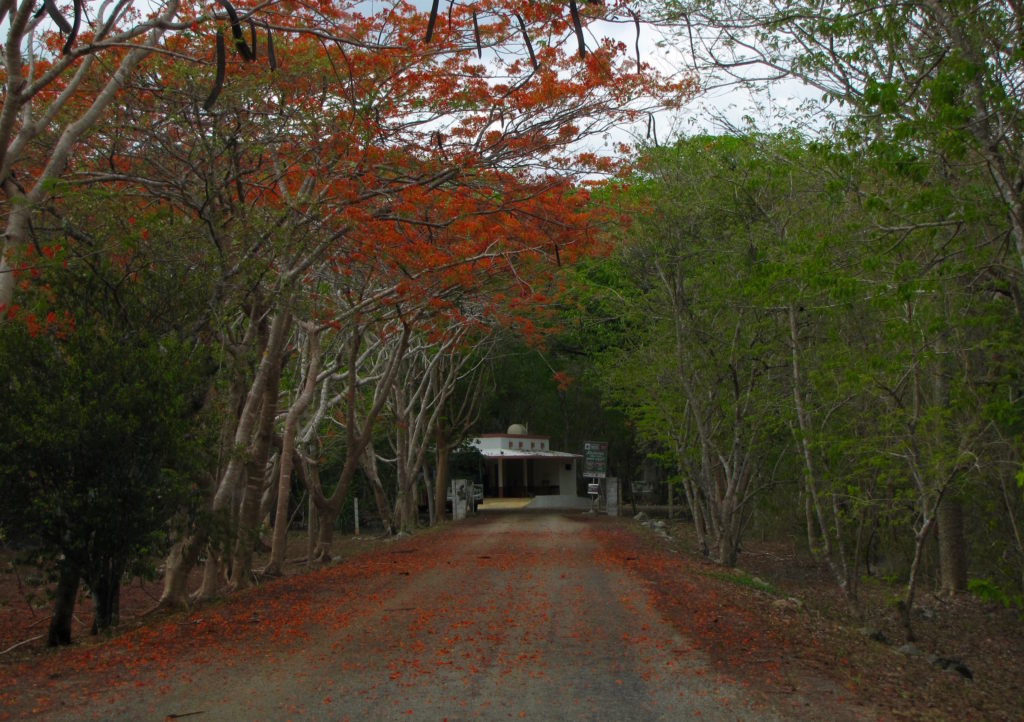
When we told Valerie, the proprietress of the Pickled Onion, that we planned to spend three nights in Campeche after leaving her hotel, she looked at us with the horror and surprise of someone discovering a hidden, profound stupidity in people she had previously assumed to be normal. Even after explaining that we would use the city as a base to explore its surrounding area, we were unable to convince her that there could be any logic in giving the port town more than a day of our precious time.

Although we remained confident in our plans, Valerie’s reaction did succeed in lowering our expectations. We were therefore pleasantly surprised that evening when we arrived in the region’s colorful, well-preserved capital, a city that would soon become our favorite on the peninsula.

For travelers, Campeche offers a pleasant balance of outsider-friendly amenities—including good, reasonably priced hotels; a plethora of restaurants; excellent museums; generously distributed drug stores; and an electronics shop—without the crowds, hectic roads, or unavoidable tourist traps found in the larger centers of Mérida or Cancún. The historic center is also modest enough to be covered on foot, with narrow streets lined by sidewalks and brightly painted buildings, many of which conceal courtyards behind their opaque exteriors. The main square, too, offers a quiet, scenic place to rest and people-watch or feed the pigeons after a day of sightseeing.

While three full days out of a two week vacation would have been a lot to spend in the city itself, Campeche’s many good museums and location near several important but otherwise out-of-the way sites—including monumental Edzná, Chenes-style Hochob, and the island necropolis of Jaina—meant that we left feeling our time there had been too short.
Highly subjective personal rating: 8/10


Loltún (aka, Lol-tun or Grutas de Loltún) is an expansive network of caverns located in the northern Puuc region of the Yucatán Peninsula about 20 km (at least 30 minutes by car) northeast of Labná. The inhabitants of the Yucatán have used the caves here for thousands of years for both practical and sacred purposes: as a source of water, clay, and shelter; as a burial place; as a pilgrimage destination; and, more recently, as a defense during the Caste War (1847-1901).
Despite my initial enthusiasm for what promised to be a naturally and culturally fascinating site, as the day of our visit approached I found myself torn about embarking on another cave tour after our experience at Balankanché. On the one hand, I had been looking forward to seeing Loltún’s rock paintings and in-situ artifacts for months. On the other, I really did not enjoy the sensation of having my lungs squeezed or the subsequent panic attack that came with it. Therefore, the night before we were scheduled to head to Loltún, I decided to read some of the more recent descriptions on TripAdvisor to get a better sense of what we were in for.
That decision turned out to be a mixed blessing. While I didn’t find any signs we would experience the same level of discomfort we had at Balankanché, I did come across a few reviews by angry visitors stating that after paying the entrance fee and going on the tour, their guide had insisted upon tips of 500 pesos (between $25-$30) per person. Not only was this much higher than the going rate for guides at any other place we had encountered, but when taking the day’s expenses of hotel and gas into account, it was more cash than we had. In addition, ATMs—like gas stations—are fairly rare commodities in this area; the only one we knew of for certain was at Uxmal, but there was no way of getting to it without spending precious time and gas driving out of our way and then paying for parking again.
After some debate, we decided to take our chances and stick to our original plan of going to Loltún, put aside as much cash as we could, and just look for ATMs along the way. (We didn’t find any.) After all, we reasoned, if guides wanted to require high, unstated costs that most visitors couldn’t reasonably be expected to be prepared for, surely there must at least be an ATM at the site. (There wasn’t.)
By the time we finally reached Loltún, we were low on both cash and gas, leaving me high on anxiety. At the welcome center, we looked in vain for any indication of what the cost of the guide should be, but saw only the (also rather high) entrance fee. We swallowed hard and paid for our tickets, then waited.
The crowd grew considerably over the next 20 minutes, until eventually the guides approached and shuffled us into two, large groups of around 12 people each. Although tours were supposed to be available in English or Spanish, and although there were still several guides who did not accompany either group, both tours were in Spanish. I was disappointed until I realized that being handled like extra luggage rather than actual members of a tour relinquished us from the pressure of giving a particularly high tip. I was finally able to relax. A little.
Without the insight of a guide, we relied on the dual-language signs posted at some of the important stopping points along the path, as well as Andrew Coe’s guidebook, for information on the history of the cave. Mostly, though, we just focused on what we saw and tried not to fall as we slipped over slick, sometimes steep, and often dark paths that connected the caverns’ dramatically lit highlights, including the roughly carved “Head of Loltun;” hand paintings; and the giant “Room of Inscriptions,” which is naturally illuminated by two, large holes in its ceiling. Crucially, these openings let in air as well as light, and are thus partially responsible for the cave’s relatively cool—and breathable—climate. Even with the more pleasant temperatures, however, the caverns were still quite humid and some of the smaller spaces became less-than-comfortable when filled with people. The precariousness of the paths, too, make Loltún a destination that requires at least a moderate level of fitness and lack of fragility, not to mention a pair of good, grippy shoes.
Even though we couldn’t follow most of what was being said, the guide still enabled us to navigate the sometimes precarious terrain, in one spot acting as a physical anchor and pulling us up a particularly difficult incline. At the end of the tour, we handed him all the money we had set aside (minus a small amount held back for buying the gas we would need to get to Campeche that evening) and he accepted it with a thank you and without a second glance.
Would we go back? Probably not. Even a year later, a smog of stress still hangs over my memories of our visit. But much of what we saw was spectacular and unlike anything we encountered elsewhere. All-in-all, I’m glad we went and mostly wish I hadn’t worried so much along the way.
Highly subjective personal rating: 6.5/10 [Actual content of the caves: 8/10; experience leading up to and during the tour: 5/10]


Driving another three km east from Xlapak took us to Labná, the last of the ancient cities along the Ruta Puuc included within Uxmal’s World Heritage site. Labná is a bit smaller than Kabah and Sayil, and is one of the oldest cities of the region. The primary buildings, including the palace, gateway, and mirador (observatory), are notable not only for their unusually well-preserved state, but for being particularly emblematic of the Puuc style in both architecture and decoration, with myriad long-snouted masks, attached columns, step-and-fret designs, and even figural reliefs gracing their exteriors.
According to the entranceway plaque, Labná’s origins likely date “from around the beginning of our era,” although the remaining structures are the result of multiple building phases from 750 to 1000 CE. Like the other cities in this arid area, Labná depended on its ability to catch and store rainwater, which it did using nearly 70 chultuns (narrow, domestic cisterns) and a natural aguada (sealed depression in the land, similar to a cenote).

The palace is the first major building visitors encounter within the archaeological area. Set on a platform and facing the sacbe that still connects it to the residential and mirador groups located directly to the south, this structure is the largest of several buildings that make up the “palace group.” Although shorter and less imposing than Sayil’s three-story version, Labná’s palace has the relative advantage of being more accessible and better preserved. And its many nooks and crannies do benefit by close inspection.


From the palace, visitors can take a path east to the “Edificio de las Columnas,” an L-shaped residential structure built in the Puuc Junquillo style, or walk south to Labná’s most distinctive feature: its gate.


As an imposing structure that simultaneously limited and permitted movement between two plazas, the gate would have both connected and demarcated the spaces of the residential group to the west of the sacbe and what was likely a ceremonial center to the east [ref. map]. Iconographically speaking, the western face is the more exciting façade, with its miniature huts flanking either side of the archway. Each hut’s niche once contained a brightly painted stucco sculpture of a seated warrior, remnants of which are still extant today. The blue-green headdress and red walls are especially visible in the niche to the right (south) of the central doorway.


For us, the gate is also memorable as the place where, while trying to 123D Catch the exterior, Josh smacked his head, skinned his shin, and bruised his foot falling down a pile of rubble. The experience was a good reminder to stick to the better-worn paths or, at the very least, to avoid unsure footing while wearing sandals.

To the east of the gate stands el Mirador, a 20 meter, pyramidal heap of stones topped by a small temple with a giant roof comb.

The many support stones on the south side of the comb are evidence of elaborate stucco work that once covered the front of the building and, like the archway, was probably brightly painted. Although we know from early descriptions that most, if not all, of this decoration consisted of human figures, very little of the original ornamentation has survived [ref. image]. Fortunately, it doesn’t take a great deal of imagination to understand that this area—which is still impressive in its denuded state—would have been spectacular in its original condition.

We eventually returned to the welcome center via a more shaded (and rather beautiful) path on the western side of the site before once again hopping into our car and heading to Loltun cave, our final archaeological stop in the region and of the day.
Highly subjective personal rating: 7.5/10

Whether you’re into automata; infinity rooms; female grotesques; pan-Asian decorative arts; antique guns; circuses; scrimshaw; sea monsters; stained glass; heavily carpeted surfaces; discordant music; winged, semi-nude mannequins; pseudo-Victorian street scenes; or carousels of dolls riding bug-eyed ponies, the House on the Rock has something for you. Dark, convoluted, and often flat-out creepy, the three-part complex located in the forests of southwestern Wisconsin is a call to imagination, a celebration of fakery, and a product of the extreme “eccentricity” of its designer, Alex Jordan, Jr. (1914–1989). Making one’s way past the indiscriminate jumbles of stuff that fill the multitude of tiny nooks and massive, elaborately constructed vignettes can feel like a journey through the mind of a mad man, but one that is as fascinating and surprising as it is exhausting and disturbing.
Jordan opened the original house in 1959 and built the more carnivalesque second and third sections over the next three decades before selling the complex in the late 1980s. The newer owners have continued to expand on the original site, adding an aviation exhibit and, in 2008, opening a welcome center and museum dedicated to Jordan’s life.
I owe particular thanks to Joshua Albers for this post, whose camera and low-light photography skills did laps around mine. Whenever possible, I’ve used his photos from our visit and supplemented the group with my own. All videos are his.


Bonus Videos:

Departing from Sayil, we continued east for 5.5km until we reached another gravel drive branching off to the south, this time leading to Xlapak.
Unlike the other stops along the Puuc Route, little Xlapak is not officially inscribed by UNESCO within the Uxmal World Heritage Site. This is probably because the visitable area includes only one well-preserved building (Structure 1, aka, the “palace”), while the rest of the former city still lies in near-complete ruin. And yet, the singularity of this building, which seems to stand alone within an encroaching jungle, lends it a jewel-like quality unmatched by the larger and more elaborate structures elsewhere.

From the parking area, we followed a stone-lined footpath under a canopy of slender but densely growing trees. After the open and expansive locations of Sayil, Kabah, and Uxmal, the trail through Xlapak felt unusually intimate—almost eerily so.
After about 200 meters, we arrived at the north façade of the palace. This is the best preserved part of the building, with its step-and-fret frieze bordered by three sets of long-nosed masks stacked in triplicate at the corners and above the central doorway.

The frieze wraps all the way around the building (or did at one time, when the exterior walls were still fully intact), and it’s probable that the east and west sides were once identical. Likewise, the design of the south wall is similar to that of the north, in that both originally possessed three doors and a frieze divided into two equal sections.

However, the southern façade boasts two large masks above its central doorway, just to the right of the pile of rubble that was once the structure’s southwest corner, that are unlike anything else on the building. With their long, hooked noses and modular construction, these faces bear some resemblance to other Puuc depictions of Chaac or Witz. And yet they also display unusually wide mouths, the upper jaws of which are filled with regular, serrated teeth. The noses, too, are turned in the opposite direction of most Chaac masks, curving upwards rather than down. It is unclear whether these differences are iconographically significant or simply a matter of style, but it is possible, as Andrew Coe has suggested, that the faces represent Tlaloc, the goggle-eyed rain god of central Mexico, rather than the Maya counterpart of Chaac (370).


Continuing down the path leads to Group 2, but there is little to see here for the casual visitor. So little, in fact, that we have no photographs from this part of the site and I can no longer remember what it looked like. In another context, that might have been disappointing. At the time, however, we still had two more sites to visit that day before we needed to drive to Campeche and leave the Puuc behind. As a result, we were actually grateful to find the rest of the site undemanding and kept our time there brief.
Highly subjective personal rating: 7.5/10 [Although there is less to see here than at the other stops along the Puuc Route, Xlapak’s compact but scenic grounds offer a pleasant break from its more overwhelming neighbors. Also, it’s free to visit.]
All photos by Renée DeVoe Mertz, May 24, 2o15.

On day two of our Puuc Route adventure, we followed Highway 261 south for just under five km past Kabah, then turned left onto a narrow, unnamed road. After another five km of doubt, we came upon Sayil, our first destination of the day. Turning right (south) off the unnamed road, we drove beneath a canopy of bright orange and green foliage up to the parking lot.
 After paying the modest entrance fee, visitors walk about 100 meters south to a clearing and the site’s most impressive structure, the Great Palace.

According to the accompanying plaque, this monumental, three-story structure was built in several stages during the Late Classic period, mostly from 800–1000 AD. By the time of completion, it contained over 90 bedrooms and eight chultuns, and could have housed as many as 350 people. Its primary function was probably to serve as living quarters for the city’s governing elite, but some rooms were likely used for storage or administrative purposes.


In addition to its palace and unusual trove of artifacts related to non-elite life, the sprawling grounds of Sayil are particularly valued for their avian diversity, attracting bird watchers and archaeology buffs alike. As we followed the sacbe through the rest of the visitable area, we were pleasantly surprised by the variety of fauna we encountered. The only place we saw a more diverse range of wildlife was at Calakmul, the massive, isolated site and nature preserve located over 300 km to the south near the border of Guatemala.
Highly subjective personal rating: 7.5/10


All photos by Renée DeVoe Mertz, May 24, 2015, unless otherwise indicated.

After a full morning at Uxmal (and much needed siesta at the Pickled Onion), we drove south-east to our next stop on the Ruta Puuc: Kabah.
As one of Uxmal’s closest and largest neighbors, Kabah was once connected to the larger city by means of a 30 km sacbe. Today, Highway 261 unites the sites. Visitors park on the west side of the modern road, then cross to pay the entrance fee and explore the remains of two palace-style structures.

From the guard’s office, we passed over the open field and climbed the raised platform on which the city’s temples and elite residences once stood. Towards the front of this low plateau sits Kabah’s best preserved and most ornate building, the Codz Poop [“rolled matting”], also known as the “Palace of Masks.”


As its nickname suggests, the Codz Poop is best known for the 250+ interconnected Chaac masks covering the west-facing façade. Although the lower portion of this wall remains remarkably intact, relatively few embellishments still grace the upper register. Instead, unassigned fragments of the modular faces—mostly upper and lower eyelids—sit in stacked pairs on the ground at the foot of the structure.

Despite the façade’s partially ruined state, it’s easy to imagine that at its peak, when the wall of faces was not only intact but brightly painted and possibly decorated with hundreds of lights perched on the Chaacs’ long, angular noses, the effect would have been overwhelming, intimidating, and, ultimately, sublime.

Viewing the same building from its east side, however, gives a very different impression. In contrast to the uniformity of the front, the rear decoration is clearly divided into lower and upper registers. The sections between the doorways are covered in the cross-hatching patterns of abstracted mats—from which the building gets its name—while the scant remains of the section along the roofline host two figures in the round. Although one of these warriors is now missing his head, both wore elaborate feathered headdresses, the depictions of which are clearly visible in low-relief on the stone wall behind the statues.

The militaristic theme continues on the late-9th century doorjambs located on either side of the east façade’s main doorway. Aside from their value as rare examples of highly legible, in-situ Puuc reliefs, the doorjambs are especially fascinating for the clues they provide (and questions they raise) about the history of the region. In addition to the inclusion of glyph dates between the upper and lower scenes of each jamb, the carvings also depict warriors possessing attributes associated with central Mexican cultures, including atlatls (spear throwers). Their presence is evidence of contact between the Toltec and Maya, and may suggest an early Toltec invasion of the Yucatan.
[For more information about the dates on the jambs, see “The Reading of Two Dates from the Codz Pop at Kabah, Yucatan,” by David Stuart and Meghan Rubenstein of the University of Texas at Austin.]


After taking in the second “palace” and carefully crossing back over the road, we followed the trail from the parking lot to a free-standing Maya arch that marked the beginning of the sacbe that connected Kabah to Nohpat and Uxmal. Aside from this one large but unadorned structure, most of the ruins on the west side of the highway, including Kabah’s great temple, remain overgrown and unreconstructed. Without a wealth of ruins to hold our attention, our focus shifted to other aspects of the landscape, including the hard-working dung beetles who shared our path.
Highly subjective personal rating: 7.5/10 [The Codz Poop is outstanding, but after Uxmal, the smaller site is bound to feel a little underwhelming by comparison.]


All photos by Renée DeVoe Mertz, May 23, 2015, unless otherwise indicated.


All photos by Renée DeVoe Mertz, May 23, 2015.