X’batún cenote. Photo by Renée DeVoe Mertz/Joshua Albers, May 22, 2015.
We said goodbye to Mérida on the morning of our fourth day and headed towards the heart of the ancient Puuc region, where we would spend the next two nights. Before diving into our next archaeological adventure, however, we took a slight detour to the X’batún and Dzom-Bacal cenotes. These swimming holes, located about halfway between Mérida and Uxmal off Highway 261, are popular spots for locals, and we shared our time there with families and elderly couples alike.
Bees and their honeycomb at X’batún. Photo by Renée DeVoe Mertz, May 22, 2015.
Despite a general lack of signage, we eventually found our way to the check-in point in San Antonio Mulix, where we paid and used the small bathrooms to change. Unfortunately, it was also here that our poor knowledge of Spanish finally bit us in the bum. I had read in another traveler’s blog that we would have the option of leaving our car there and renting a bike to take the rest of the way. We thought this meant cars weren’t permitted past the check-in point, making walking or biking our only options. Since I don’t ride, we chose to walk, despite the fact that it was dangerously hot and the cenotes were well over a mile away. [Note: Google Maps claims it is only a 0.1 mile, two minute walk to X’batún; that is WRONG.] As we started out, every person we passed looked at us like we were crazy—which we probably were—but we just smiled in return and kept plodding towards our destinations. Eventually, a concerned man came down from one of the few structures along the way to ask why we were going by foot. After a little back and forth, we finally understood that cars are permitted by the cenotes, leading us to very gratefully turn around and get ours.
Wasps’ nests clinging to the limestone outcroppings at X’batún cenote. Photo by Renée DeVoe Mertz, May 22, 2015.
X’batún is the better known of the two cenotes, perhaps because it is the easier one to photograph, with bright, blue-green water dotted with lily pads and filled with colorful fish. The swimming area is partially surrounded by cliffs—from which long tree roots and wasp nests picturesquely hang—and partially by an open, limestone landing where visitors can enter the water. This short descent is still a little treacherous, however, due to the slippery vegetation that covers the submerged steps and rocks closest to shore. During our visit, one of the older visitors took what looked and sounded like a nasty fall on these stones (although that did not deter him, after a dazed moment, from staying and playing with his friends).
A sampling of the many fish living in X’batún cenote. Photo by Renée DeVoe Mertz, May 22, 2015.
In contrast, the swimming area in Dzom-Bacal is located almost entirely beneath a limestone outcropping and is barely visible to visitors as they walk down the long staircase into the cenote. The cave-like surroundings keep the water particularly cool and blue, with very little flora growing on or between the rocks. Floating in the giant, liquid sapphire, we watched the few tiny fish swim around us while swallows darted back and forth in the low space above our heads. It was an incredibly beautiful experience, and one of the most serene moments of our trip.
Dzom-Bacal cenote. Photo by Renée DeVoe Mertz, May 22, 2015.Dzom-Bacal cenote. Photo by Renée DeVoe Mertz, May 22, 2015.
If you go—to these or any other cenotes—remember to not wear sunblock or other lotions, as these will wash off and harm the natural flora and fauna. Large hats and long sleeves are therefore imperative for protecting yourself when out of the water, and the time spent in well-lit swimming holes, like X’batún, should be limited.
On the morning of our first full day in Mérida, we hopped back in the car and headed north of the city to Dzibilchaltún.
Located on a hot, dry plain about 22 km south of the coast, Dzibilchaltún has the honor of possessing the least picturesque ruins of the 20-plus Maya sites we visited. However, what the destination lacks in architectural or decorative splendor it makes up for in historical importance and, thanks to its cenote, natural beauty. The on-site museum—which consists of both indoor and outdoor displays of artifacts, stelae, and anthropological installations—is also quite good and added significantly to our appreciation of the site.
First occupied around 800 BCE, Dzibilchaltún was one of the earliest major settlements on the peninsula. As a result, some of the oldest known ceramics of the region come from here. The local economy was based on salt trade, and the relative strangeness of the city’s location—which is both inhospitable and fairly far from the sea—can be understood as a compromise between finding land that was capable of supporting a minimal amount of agricultural cultivation while simultaneously as close to the salt-producing coastal lagoons as possible. Of course, the presence of a cenote, offering fresh water in an otherwise arid environment, would have been a key factor in the choice of locale as well.
At one end of the traversable ruins stands the site’s most iconic building, the Temple of the Dolls. Named for the seven, rough, ceramic figures once buried in front of its altar and now on display in the museum, the temple sits in near isolation at one end of a large, open plaza. Doors located at the center of each of the sanctuary’s four walls heighten the effect of the square building’s rather unusual radial symmetry, while skeletal remnants of Chaac masks sit above these entrances and at the roofline’s four corners. Like many surfaces at the site, the masks (and numerous nearby stelae) were once covered in sculptural, painted stucco. Archaeologists have discovered graffiti inside the temple as well, some of which may date to 1200–1520 CE, when Maya pilgrims reopened and restored the sanctuary. Unfortunately, the building itself is no longer accessible and must be appreciated from a distance.
Running east-west, a long, straight sacbe connects the Temple of the Dolls to Dzibilchaltún’s central square. Visitors can either follow this road to the rest of the site or walk along a parallel (and more shaded) path part of the way. Those who take the sacbe will also pass another, circular trail that leads to very little.
The central plaza consists of a few, spread-out structures, including a small pyramid, an open Franciscan chapel, stone bleachers, and a gateway. On the other side of the gateway lies the Xlacah Cenote, perhaps the site’s greatest highlight.
Swimming is allowed, albeit “at your own risk,” but there is no changing room or shower on the grounds.
As an oasis in an otherwise parched landscape, the water here is teeming with life. During our visit, the pool seemed especially hospitable to lily pads and various fish, the latter of which struck us as a little too eager to swarm a bit of flesh and check it for possible food. We spent the majority of our time at Dzibilchaltún admiring the cenote and its surrounding flora and fauna, but left the swimming for another day.
Although I don’t imagine myself returning to Dzibilchaltún, the cenote and museum alone made it worth a visit. If you go, arrive early to beat the tourist groups bused in from Mérida. There is no escaping the sun, so having a hat, sunblock, and plenty of water is especially important here.
Last spring, Josh and I embarked on a two week road trip around Mexico’s Yucatan Peninsula. We had hoped our travels would fall in the window between high tourist season and the hot, rainy days of summer. In reality, the weather turned out to be unseasonably warm, with temperatures in the 90s (or higher) nearly every day. Despite the fact that neither of us are built to withstand that kind of heat—often to our great, sweaty, fainting embarrassment—we both agreed that this was one of the best trips we have ever taken. The people were friendly; the ruins, fascinating; the cenotes, stunning; the iguanas, hilarious. And we were able to avoid many potential frustrations and pitfalls by following a few basic rules of thumb. Therefore, I thought I’d start this series of posts with tips for anyone interested in making a similar pilgrimage.
1. Do your research.
Anticipation is half the fun of travel, and research allows you to dive into your trip long before you leave home. Just as important, knowing where you want to go and how to get there will save you valuable time and stress during your all-too-brief holiday. Not all of the most interesting sites are covered in your guidebook or are easy to find, and not all of the differences in hotels are evident from their exteriors. I put in months researching what we would see, where we should stay, who we should rent our car from, and what routes we should take. The downside of all this planning is that we couldn’t be terribly flexible. These days, most hotels will not let you cancel without penalty unless you do so weeks or even months in advance. The upside is that we could be confident we were staying in safe, comfortable locations for a good price. And because I did a lot of online reading about the various sites we could visit, we only had one instance in which something new came up that we had to miss out on. Also, reading ahead of time about the history of the places we would see made us less inclined to hire guides, saving us money and freeing us to focus on wandering and looking.
Sources I found most helpful:
Books
DK Eyewitness Travel, Mexico
Andrew Coe, Archaeological Mexico
Even the second edition, published in 2001, is out of date, which means many of the things he recommends to do at the most trafficked locations are no longer accessible. Despite that inevitable disappointment, the book is still worth reading for the detailed insights it provides on many sites.
David Drew, The Lost Chronicles of the Maya Kings
Focuses on Classic period Maya civilization, which was based in or around Guatemala and Chiapas. Includes some information about Calakmul (which is still scarce elsewhere) and the post-Classic sites of the Yucatan. Mostly useful for historical background and context.
Internet
Google
Image searches are especially helpful in discovering places that do not yet appear in guidebooks or may not have otherwise been on your radar. Of course, if you’re here, you probably already know this.
Google Maps
Invaluable for planning routes.
TripAdvisor
A great, centralized source for reviews and images of sites, hotels, restaurants, and rental agencies.
Wikipedia
Most entries for archaeological sites give geographical coordinates that can be copied and pasted into Google Maps. This is extremely helpful for planning your route to more remote locations.
Expedia and Hotels.com
I generally found the best deals on hotels through these two, but as new budget travel sites seem to pop up all the time, something else may work better for you.
2. Travel with a buddy!
Seriously. This is not so much for safety (the Yucatan is a pretty safe place for visitors), but because it makes the logistics of travel significantly easier. Perhaps most importantly, you will need one person to navigate while the other drives. Even if you are using GPS apps, keep in mind that what they say is often less accurate than what they show and that these navigation lags are especially tricky in locations with lots of unnamed roads. You will need one person to keep eyes on the digital map and correct what the electronic voice tells you to do.
3. ALWAYS have plenty of bottled water. Dried fruit and fruit soda are good too.
We each went through a medium bottle of water or more per site (about the equivalent of four small bottles per person, per day). Most hotels will provide a bottle, either free in your room or for purchase at the front desk, and the larger sites will have them for sale as well. Even so, it’s smart to hit a local convenience store and stock up whenever you can.
I also found that being active in the heat meant that the only consumables I wanted before the sun went down were moisture and sugar. We packed one bag of dried fruit and ate it all on our first full day. Another packet of fruit and nuts lasted a little longer. I wish we had brought more, as dried fruit is not a popular snack in the Yucatan. If you decide to bring food with you, remember that it must be in a commercially sealed, prepackaged container when you arrive at customs.
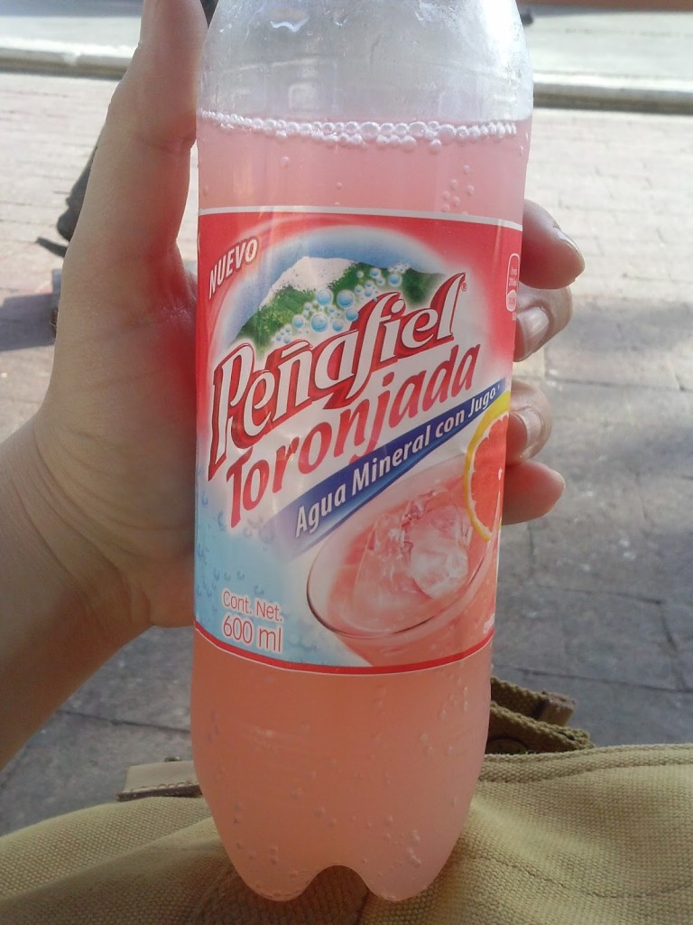
Once we ran out of dried fruit, cold fruit soda became my new favorite thing.
This.
4. Use a GPS map (and have a back-up).
If you are renting a car, it’s probably because you want to hit some of the less traveled destinations. And if you are driving to less traveled destinations, then FOR THE LOVE OF HUMANITY HAVE A GPS! And make sure it doesn’t require you to be on a network. Most rental car agencies have the option of getting a car with GPS, but this extra feature can be expensive. Instead, we used a combination of Google Maps and the “GPS Navigation and Maps Scout” app on our phones. Having a second device was helpful not only to compare accuracy, but as a back-up in case the primary phone died during the day. Keeping a spare battery charger on hand is also never a bad idea.
5. Learn some of the language.
If you don’t already speak Spanish, you should make the effort to learn a little before you go. Most of the time you can survive without it, especially when in the larger cities or major sites, but it’s still useful for road signs, menus, and talking to cops at check-points (and yes, you will get pulled over at at least one checkpoint if you drive around the peninsula). Besides, it’s just polite to at least try to speak to people in their own language in their own country. Even if you’re bad at it (as I am), people usually appreciate the effort.
6. Get to sites when they open and don’t over-schedule yourself.
Roads here are better than they used to be even a decade ago. Still, if you are used to driving on highways, most Yucatan streets will be a shock. On the other hand, if you have done a lot of driving in the rural midwest, you might feel right at home. Either way, keep in mind that going short distances can take a long time, especially when you are off the main thoroughfares. Additionally, the heat is no joke, even for locals. Try to get to places when they open to beat both the crowds and the afternoon sun. Stick to the shade as much as possible. Take a leisurely lunch. Don’t plan to do a lot of sightseeing after mid-day.
Taken shortly after opening. An hour later, this area was covered in fellow tourists.
7. Wear a lightweight, wide-brimmed hat; sunscreen; and bug repellant.
If you are going to Mérida, you will find many wide-brim options available. I brought a cheap hat with me, but eventually replaced it with a far superior, locally made jipihapa. I also recommend Avon’s Skin-So-Soft sunscreen/bug repellent combo. You will need both aspects of this product pretty much everyday, and it works well without making you smell like bug spray. Two adults using it conservatively everyday for two weeks requires a little more than one bottle. Bring two to be safe.
View along the tollway connecting Cancún and Mérida.
8. Take the toll roads.
They are much nicer and will save you a ton of time and aggravation. Make sure you have cash, especially small bills, when you leave Cancún.
9. Tip everyone who does something for you.
Another reason to always have cash on-hand. Many jobs in Mexico are largely or entirely tip-based, including gas station attendants (who you must use), hotel staff, and tour guides. Often, if people don’t get tipped, they don’t get paid. Rules on the appropriate amounts vary, but if you can be generous, be generous. If you can only give half the change in your pocket, give that. One of the most challenging aspects of our trip was making sure we always had change or small bills on us, and we did not always succeed.
10. Do as the locals do (most of the time).
Obviously. But this particularly applies to driving. Here are a few specific things to keep in mind:
•Shoulders on highways are meant to be used. Pay attention to the cars behind you; if they want to pass, move onto the shoulder so they can get by.
•Obey the traffic signs. This is an area where your behavior should probably depart from most of the locals with whom you’ll share the road.
•Reduce speed around towns and look out for road humps. Even if speed limit signs are not present, vehicular speeds are controlled by road humps of variable sizes. The higher the hump, the lower the required speed. If you aren’t paying attention or choose to ignore the signs alerting you to upcoming humps, you will damage your car. And possibly your head.
•Top-up the car with fuel before leaving a city or large town. It may be a while before you come upon another gas station.
•Don’t drive at night, especially in unfamiliar places. We broke this rule three times, and while I don’t regret any of those instances, I also still believe this is an important guideline for safe travel (to avoid collisions with cars parked in the road, stray dogs, significant potholes, etc.).
11. Be respectful. And relax.
As is true almost everywhere, if you are respectful of the places you visit and kind to the people you meet, they will return the favor. And, again, the Yucatan is a fairly safe place for travelers. Be open, enjoy yourself. You’ll be fine.


 chapel built from Maya masonry, Dzibilchaltún. Photo by Renée DeVoe Mertz, May 21, 2015.")